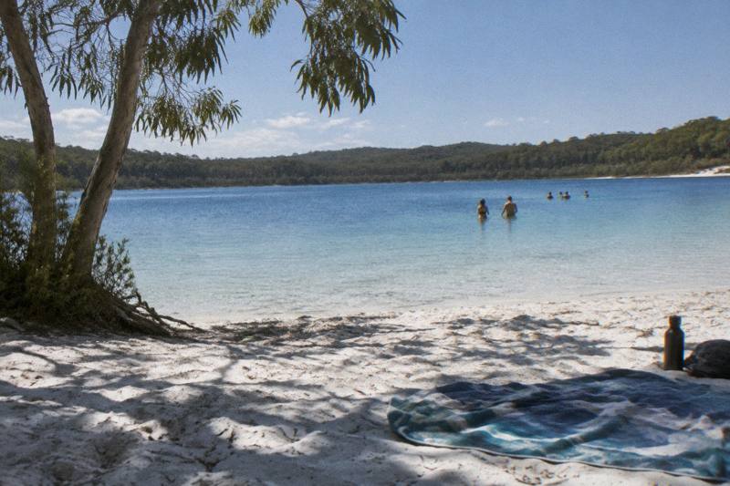
Fraser Island Map: Where Every Stop Sits
K'gari runs 123 km from north to south, and almost every question visitors ask is really a question about position: how far north is the champagne-coloured water, how far south is the barge, and how much of the island a single day can reach. This guide walks the map from end to end.
Short answer
K'gari is a 123 km sand island with three practical gateways: Hervey Bay ferries from River Heads on the west, the Manta Ray barge from Inskip Point to Hook Point in the south, and tour pickups at Hervey Bay, Rainbow Beach or Noosa. The famous stops, Lake McKenzie, Eli Creek and the Maheno wreck, all sit along the eastern beach road, which is why most day tours follow the same arc.
K'gari, the island most listings still call Fraser Island, is 123 km long and covers 166,038 ha, making it the largest sand island in the world. That single fact explains most of the map. The island is thin, the interesting geology is packed along its eastern beach, and the distance between the southern barge crossing and the northern lakes is a real drive, not a hop. Queensland Parks manages the island as the K'gari (Fraser Island) section of the Great Sandy National Park, and the island's name was changed in stages, first the park section, then the World Heritage Area, then the island itself, to K'gari, the Butchulla name meaning paradise. Fraser Island remains the name most people search. Once you have the island's layout in your head, the guide to the best things to do on Fraser Island helps you decide which lakes, wrecks and rainforest walks are actually worth the long drive north.
This guide walks the island the way a map reads: north to south, then the western side, then the gateways on the mainland. Along the way it points to the tours that actually reach each part, because on an island with no sealed roads, position and transport are the same decision. The nine-hour coach day tour from Hervey Bay, the boat tour to a remote western beach and the two-day explorer style trips each cover a different slice of the map.
How Does The Island Lay Out From North To South?
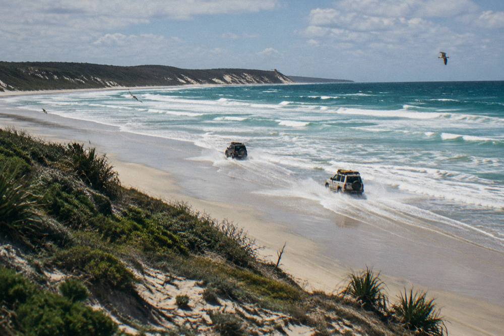
The island is a long, narrow sand mass running roughly north to south, with the resort village at Kingfisher Bay on the west, the fishing and touring hub of Eurong on the east, and the barge landing at Hook Point at the southern tip. Driving between the extremes means the eastern beach at low tide or slow inland sandy tracks. Nothing on the island is sealed. The eastern beach is the island's main highway, and Queensland Parks advises driving it at low tide or within two hours either side. Inland tracks are sandy, slow and only suitable for high-clearance four wheel drives, preferably with low range. A vehicle access permit is required for every vehicle driven on the island, at $61.80 for one month or less or $311.00 for longer stays, and driving without one draws a $518 penalty notice.
For context on scale, the UNESCO World Heritage property covers 181,851 ha including adjacent small islands, and the listing, made in 1992, cites more than 250 km of clear sandy beaches. The island's shape matters for planning: the eastern side holds the famous freshwater perched lake, the creek you float down, the shipwreck and the coloured sands, while the western side faces Hervey Bay and is where the ferries and the whale-watching fleet operate. Most visitors touch one side deeply or both sides briefly, rarely both deeply.
The practical read of the map, then, is three horizontal bands. The southern band, from Hook Point up to the Eurong area, is what a day tour from Rainbow Beach or a self-drive crossing can comfortably reach. The middle band, from Eurong to Central Station and Lake McKenzie, is the standard day-tour loop from Hervey Bay. The northern band, the lakes country around Orchid Beach and the Champagne Pools, is realistically a two or three day proposition, which is exactly why the multi-day tours exist.
What Are The Main Regions On A K'gari Map?
Five regions cover everything a visitor needs: the southern gateway around Hook Point and Dilli Village, the middle east coast around Eurong and the Seventy-Five Mile Beach drive, the central sandbelt holding Lake McKenzie and Central Station, the far north around Orchid Beach, and the western side facing Hervey Bay. Each region has its own access logic and its own tour type. The table below sets out the regions and what sits in them, and it is the single most useful thing to internalise before choosing a tour, because tour itineraries are really region lists in disguise.
| Region | Where It Sits | What The Map Shows There | Realistic Visit Style |
|---|---|---|---|
| Southern gateway | Hook Point and inland to Dilli Village | Barge landing, first sandy tracks, forest drives | Day trip from Rainbow Beach |
| Middle east coast | Eurong north along the beach drive | Maheno wreck, Eli Creek, coloured sands, Pinnacles | Day tour loop or self-drive |
| Central sandbelt | Inland from the beach to Central Station | Lake McKenzie, rainforest boardwalks, sandblows | Included in most day tours |
| Northern lakes country | Around Orchid Beach and Waddy Point | Champagne Pools, Sandy Cape, quieter lakes | Two or three day tours |
| Western side | Kingfisher Bay and the Hervey Bay shore | Ferry terminal, resort village, whale waters | Ferry, boat tour or stay |
The reason day tours cluster in the middle band is simple arithmetic. A coach day tour from Hervey Bay runs about nine hours, which is enough time for the ferry crossing, the lake, the creek and the wreck, but not enough to add two more hours of driving each way to the north. The two-day tours buy the extra time that the northern band needs, and the boat tours skip the driving entirely by approaching the western shore by water. If you want the full picture of what each region offers sight by sight, the things to do on K'gari guide breaks the regions into individual stops.
Choosing by region also keeps expectations honest. A visitor who wants the Champagne Pools should not book a one-day coach tour from Hervey Bay and hope; the map says that stop is a northern-band destination and the itinerary says the same. Matching the region to the tour is the whole game here, and the trio below spans the three most common region choices: the middle-band coach day, the western-band boat day and the two-day trip that reaches north.
Where Do You Get Onto The Island, And Where Do You Land?
There are two vehicle crossings: SeaLink runs vehicle and passenger ferries from River Heads near Hervey Bay to Kingfisher Bay Resort on the western side, about 45 minutes, with advance booking needed for vehicles, and the Manta Ray barge runs from Inskip Point near Rainbow Beach to Hook Point in the south, about 10 minutes, turn-up-and-go, every day of the year. Fares are set by the operators, change, and must be checked on their own pages. Tour guests mostly never touch either crossing as a separate booking, because every tour on this site's roster includes the crossing in its price and logistics, and the listings state that national park fees are included.
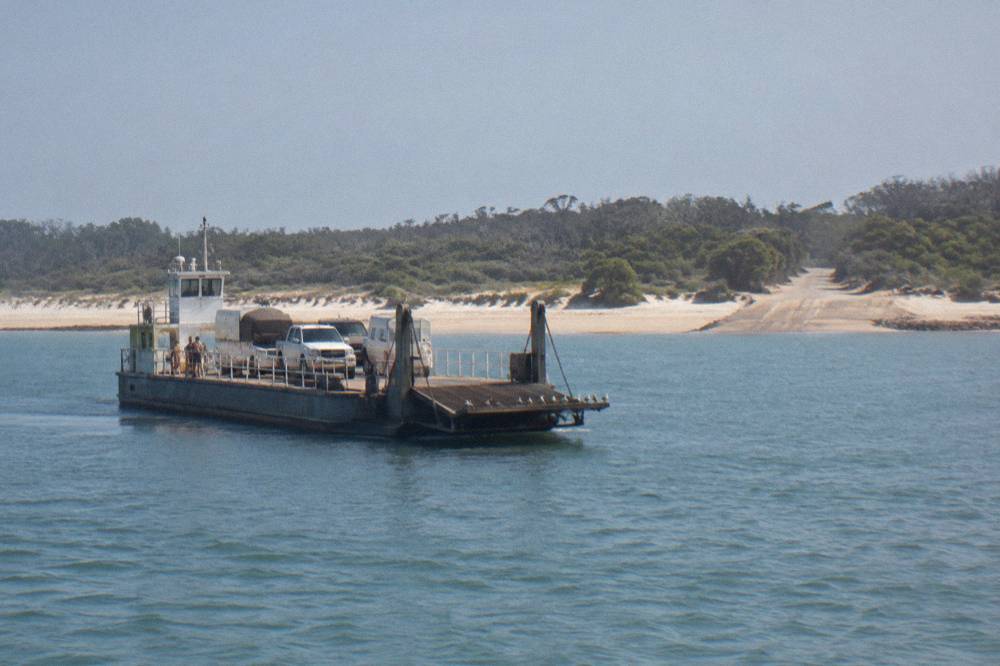
The two landings put you in completely different map positions. Kingfisher Bay sits mid-island on the west, which is the natural landing for Hervey Bay departures and for anyone staying at the resort village. Hook Point is the southern tip, which is why Rainbow Beach tours spend their first hour driving north up the island before they reach the headline sights. Neither landing is better; they are simply different starting coordinates, and the tour you choose determines which one you use. The ferry and barge guide covers the crossings in detail.
There is a third kind of access that the map shows only as water: the boat tours. Tasman Venture's remote K'gari tour by boat, rated 4.9 from 1321 reviews and from A$269 per person, leaves Hervey Bay and lands on a remote western beach, bypassing both vehicle crossings entirely. For a reader whose main interest is the island's edge rather than its interior, that is a genuinely different map, one drawn from the water, and it explains why the boat option sits beside the coach tours in most comparisons.
The all-inclusive coach day tour from Hervey Bay, rated 4.8 from 3893 reviews and from A$279 per person with lunch included, is the roster's most-booked way to see the middle band, and its route is a map lesson in itself: ferry across, lake, creek, wreck, coloured sands, ferry back. One guest review reads, "Butch was great!" That is the middle-band loop described from a seat.
How Long Does Driving Between The Sights Actually Take?
Distances on the map are misleading because the eastern beach is the only fast road, capped at 80 km/h, and inland tracks run at 30 km/h, so a short-looking hop from the beach to Lake McKenzie can take as long as a long stretch of open beach. Drivers should plan on low tide windows, reduced tyre pressures and speeds well below what the map scale suggests. Queensland Parks sets the limits plainly: 80 km/h maximum on the eastern beach, 40 km/h in beach pedestrian areas, 10 km/h in shared-use areas, 30 km/h on inland roads and 50 km/h on the Hook Point inland road. Seatbelts are required and Queensland road rules apply on the sand.
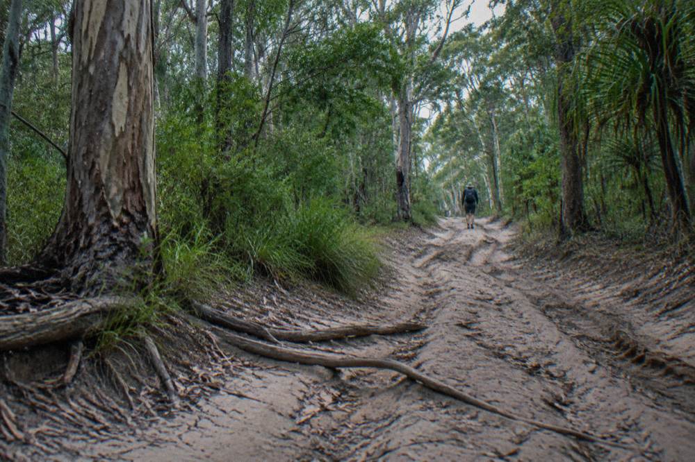
The time arithmetic is why the map and the tide chart travel together. Beach driving is best at low tide or within two hours either side, which means a day's driving plan is really a tide plan with stops attached. A self-driver who misjudges the tide can lose the beach highway for hours, while a tour driver who does this daily builds the whole itinerary around it. That asymmetry, not scenery, is the strongest practical argument for guided tours on this island, and the 4WD tour guide works through it in full.
For tour passengers, none of this is your problem, which is the quiet selling point. The Rainbow Beach coach day, Discover K'gari's Best in One Epic Day, rated 4.8 from 1239 reviews and from A$279 per person with lunch, runs the southern and middle bands in one loop with a professional driver reading the tide and the sand. A guest review from its listing sums up the experience: "A great day with great service, an excellent driver with knowledge, and sensational lunch and snacks." When the map's driving times are someone else's job, the day compresses.
The permit side of driving is covered on the vehicle permit guide, including the fee structure and the $518 penalty for entering without one. Tour guests skip all of it: the operator holds the permit, the listing says park fees are included, and the only map you need is the one in the itinerary.
Where Do The Famous Sights Sit Relative To Each Other?
The headline sights form a tight cluster in the island's middle and upper-middle east coast: Lake McKenzie sits inland in the central sandbelt, Eli Creek and the Maheno wreck sit on the eastern beach drive north of Eurong, and the coloured sands and Pinnacles continue north from there. The Champagne Pools and the far-northern lakes sit well beyond them, past the halfway mark of the 123 km island. That clustering is why a single well-run day tour can honestly claim the highlights, and why the far north is a separate trip.
| Sight | Map Position | Side Of The Island | Reached By Standard Day Tour? |
|---|---|---|---|
| Lake McKenzie (Boorangoora) | Central sandbelt, inland | East, inland from the beach drive | Yes, most day tours |
| Eli Creek | Upper-middle east coast | East, beachfront | Yes, most day tours |
| Maheno wreck | Middle-east beach drive | East, beachfront | Yes, most day tours |
| Coloured sands and Pinnacles | North of the wreck | East, beachfront | Yes, longer day tours |
| Champagne Pools | Far north near Indian Head | East, rocky headland | Rarely, mostly multi-day |
| Kingfisher Bay village | Mid-island west coast | West | Ferry or boat tour |
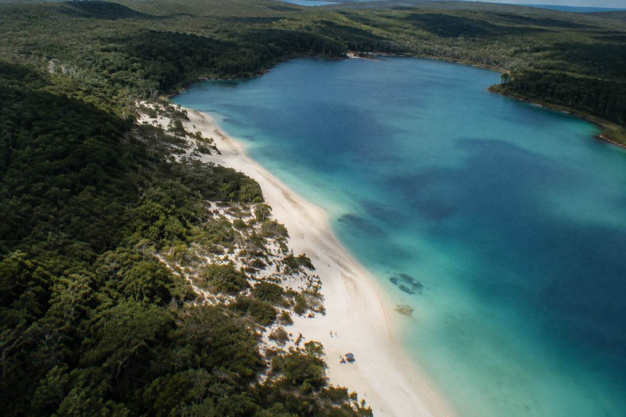
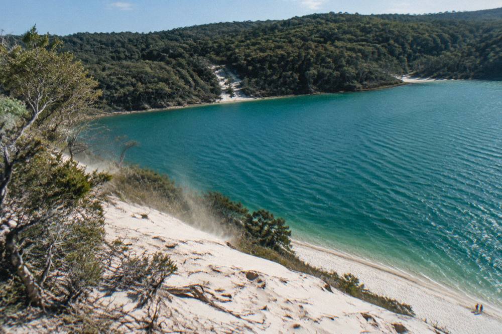
The lake deserves its own map note because it is the sight most visitors come for. Lake McKenzie is a perched lake, sitting above the water table in a sand basin, and its white silica shore and blue water are the island's signature image. The day-use area is managed by Queensland Parks, and the standard guidance applies: take no food except drinking water to lake shores, and swim in the freshwater lakes rather than the ocean, because the island's beaches are not patrolled and the sea carries rips, sharks and, from November to May, a higher marine stinger risk. The Lake McKenzie access guide covers how to reach it.
Reading the map this way also explains the island's rhythm. Every day tour, whatever its departure point, converges on the same middle-band cluster by mid-morning, which is why the lake's day-use area is busiest in the middle of the day and why the multi-day tours schedule it early or late. The far north stays quiet precisely because it is far, and the western side stays a different world because no beach road reaches it. The full index of guides sits on Kgari Island Tours.
What Does The Western Side Of The Map Offer?
The western shore faces Hervey Bay's sheltered waters rather than the open Pacific, and it is where the ferry lands at Kingfisher Bay, where the resort village sits and where the whale-watching fleet operates from July to October inside operator-published season windows. It is the side of the island most day trippers never see, because the beach highway runs down the east. The two Tasman Venture products make the west their whole territory: the remote beach boat tour and the remote island and whale experience, both from A$269 per person and both rated 4.9, from 1321 and 503 reviews respectively.
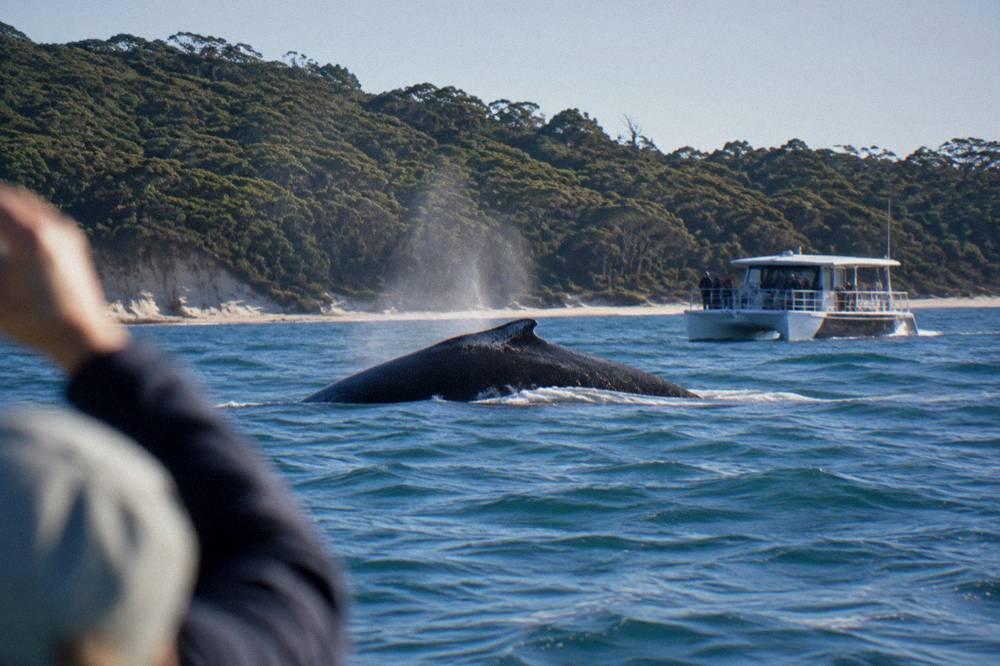
The whale season is a map fact as much as a calendar fact. Humpbacks rest in Hervey Bay's sheltered water on their southern migration, and operators publish their own windows inside the July to October span, with August and September the peak months. Sightings are wild and never promised, and the regulations are strict: vessels keep at least 100 m from a whale, 300 m when three or more boats are nearby, and swim tours, where offered, carry a minimum age of 13. The Hervey Bay whale watching guide maps the fleet.
For visitors building a full island picture, the west is also the accommodation side of the map. The two-day explorer tour from Hervey Bay, K'gari Explorer's flagship, rated 4.9 from 1120 reviews and from A$549 per person with a resort or lodge stay, uses the western landing and the eastern beach in one itinerary, which is the most map-efficient two days available. It is the tour that turns the whole 123 km from an outline into an experience.
How Do Seasons And Alerts Change The Map?
The map is constant, but the accessible island changes with the seasons: summer means mean maximum temperatures around 30 C, crowded school holidays and higher stinger risk in the ocean, spring means the dingo breeding season alert and milder walking weather, and winter means whale season, mean maxima near 22 C and the driest, clearest touring conditions. Queensland Parks publishes alerts and a conditions report that should be read before any trip. Conditions and access change, and the alerts page is the authoritative source for what is open on any given day.
Dingo awareness is part of reading the map correctly, because wongari, the island's dingoes, range across all of it. Queensland Parks states a maximum fine of $28,495 for disturbing or harming a dingo and $6,908 for failing to store food securely, with visitors advised to stay at least four car lengths, 20 m, away, keep children within arm's reach, walk in groups and never run or jog. Spring is the rearing and emergence season, when Queensland Parks runs its annual alert, and families with children under 14 are strongly recommended to camp in fenced areas. The dingo safety guide covers the rules in full.
The seasonal overlay matters most for choosing when, and the best time to visit guide works through the trade-offs. But the map-level summary is short: the island is drivable, tourable and beautiful year round, the whale months add a western-side reason to visit, and the school holiday blocks, in April, June to July, September to October and December to January, are when the middle band's sights are most crowded. Visitors who want the map to themselves travel in the shoulder weeks.
Which Tour Matches Each Part Of The Map?
Match the tour to the band you most want: Hervey Bay coach day tours own the middle band, Rainbow Beach and Noosa small-group days cover the southern and middle bands, boat tours own the western shore, and the multi-day tours are the only realistic way to hold the far north. Every roster tour departs from Hervey Bay, Rainbow Beach or Noosa, and none departs from Brisbane. The table pairs each map band with the tour types that reach it.
| Map Band | Best Tour Type | Roster Example | From Price |
|---|---|---|---|
| Middle band, east and central | Coach day tour with lunch | K'gari (Fraser Island) All Inclusive Day Tour, Hervey Bay | from A$279 |
| Southern and middle from Rainbow Beach | Small-group 4WD day | From Rainbow Beach: K'gari Full-Day Tour | from A$279 |
| Middle band from Noosa | Small-group 4WD day | From Noosa: K'gari Tour, 4.7 from 639 reviews | from A$299 |
| Western shore and whale waters | Boat tour with lunch | From Hervey Bay: Remote K'gari Tour by Boat | from A$269 |
| Far north and full island | Two or three day guided tour | K'gari (Fraser Island) Explorer 2-Day Tour | from A$549 |
The Brisbane point deserves its own sentence, because the map misleads people there too. Brisbane sits about three and a half hours by road from Hervey Bay and further from Rainbow Beach, so a Brisbane-based visitor is really choosing between a very long day and an overnight near a departure town; no tour on this roster picks up in Brisbane, and the tours from Brisbane guide sets out the honest options. The nearest real departures are Noosa in the south and Hervey Bay in the north.
For readers who want to compare the whole day-tour field rather than one band, the day tours compared guide puts the itineraries side by side, and the Hervey Bay departures guide covers the largest departure pool. The map logic is the same in every case: pick the band, then the departure town, then the format. Whether that format is the coach day with lunch, the small-group 4WD, the tag-along where you drive your own vehicle, or the boat that redraws the island from the water, the geography does not change, only the way you cross it.
The trio below is the shortlist that spans the map's three most common answers: the middle-band coach day, the western-band boat day and the two-day trip that reaches what a single day cannot.
Common Questions About The Fraser Island Map
How long is K'gari from top to bottom?
The island runs 123 km north to south and covers 166,038 ha, making it the world's largest sand island. The drive from the southern barge landing at Hook Point to the far north can take several hours each way on sand, which is why multi-day tours exist for the northern sights.
Which side of the island do day tours use?
Most day tours use the eastern side, where Lake McKenzie, Eli Creek, the Maheno wreck and the coloured sands sit along the beach drive. The western side, facing Hervey Bay, is the ferry landing side and the territory of the boat tours.
Where does the ferry land on the island?
SeaLink ferries from River Heads land at Kingfisher Bay Resort on the western side, about 45 minutes across, and the Manta Ray barge from Inskip Point lands at Hook Point in the south, about 10 minutes across. Tour passengers do not book either crossing separately, as tours include it.
Can you see the whole island in one day?
No. The middle band's headline sights fit in a nine to eleven hour day tour, but the far northern lakes and the Champagne Pools sit beyond a comfortable day return. Two and three day tours cover the full map.
Is the beach the main road on the island?
Yes. The eastern beach is the island's main thoroughfare, capped at 80 km/h, and it is only drivable around low tide. Inland sandy tracks run at 30 km/h and need a high-clearance 4WD with low range.
Do I need a vehicle permit if I take a tour?
No. The tour operator holds the vehicle access permit and the listings state national park fees are included. Permits, at $61.80 for a month or less, only apply to vehicles you drive yourself.